30 November 2009

EUREKA ! EUREKA !! EUREKA !!!

During the years 1999 to 2007 we had traveled extensively by road to all corners of India . I had prepared a road map on which full details of every journey under taken by us were recorded . All those who had a look at that map were suitably impressed ! My son suggested that I put them on the google "My Map pages " . It was a grand idea and helped me in spending considerable amount of my time in a very pleasurable hobby :-)and so the maps were duly made and posted on google "My Map pages " site after completion of the journey .

We are now in Gurgaon and have been for the last month plus to help out our DL (daughter -in -law)by doing some baby sitting and generally trying to be helpful . I have doubts about my contributions to both these tasks but I am sure and have no doubt that the DL will also agree that Priti has been doing both the tasks wonderfully well . In the mean time Google , Googgle maps , the Blog , the Gnat 50 years site and generally speaking the internet has been great help in getting me through the days and nights :-)

With time on my hand I thought of putting those maps on google earth . When trying to do that ( put my google maps on the Google Earth ) , I accidently discovered ( now you know the reason for the title of this blog:-)that google "My Maps "can be imbeded in the blog . After lot of trial & mostly errors I finally got the hang of how to do that .

It is a fair warning to all those very few followers of my blog { are there any ? :-( } that the next few days they are going to be over loaded by google maps and descriptions of our road journeys under taken through the years by car .

velu
30 July 2009

Our USA Trip 25 June 2009 T0 23 July 2009.

Our USA Trip 25 June 2009   T0  23 July 2009.


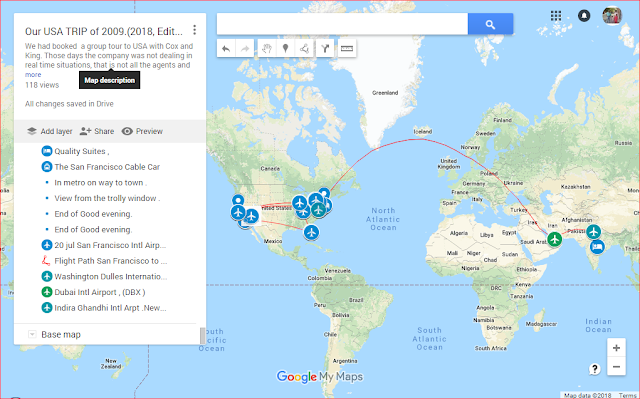
This is screen shot of map of our USA trip

This is a screenshot of that map.Unfortunately it does not open by clicking on it nor is it an interactive one . To open,interactive map go here
 OR  copy and paste following link in address bar:
https://www.google.com/maps/d/edit?mid=14p9gOdUvpKt7OPHLKBrPgz_wvIfH_BPb&ll=15.840904461238583%2C0&z=2

With this URL Interactive map should open in a new window.
To navigate through this map use the left vertical panel on the map :
1. The panel gives contents of the map which are self explanatory.Placing the cursor  on any item in the panel will highlight that item in the map .
2. Click on the item in panel will open an information window in the map giving information about that item. If photos about that item have been uploaded they will also show in the information window.
3. For example placing the cursor on first entry Home , Nahgpu  will highlight Our home location in Nagpur, with a circle. Clicking on the same , will open a information window in the map  giving information at home.
The writing in these panels is slightly faint. Unfortunately I have not been able/ do not any thing about how to make it dark and better to read . Any help on that will be most welcome . To navigate through the info panel,use the Up/Down arrows given at top & bottom in the right margin.
2. There are various layers .Sequance of the layers is from top to Bottem.So,First layer is the start of the trip.Entries in layers show what it deals with.  
I have explained about first entry . Second entre shows train route from Nagpur to New Delhi. So on and so forth. This way Navigate through the map.  
3. Each successive layer shows the progress of the trip.
4. Last layer shows final leg of air travel travel on the return trip.
Going through the map will give you more than fair idea about the whole trip.


Hope you enjoy the trip .